Mapping Culture: A Journey Through Indigenous Heritage and Ecological Diversity
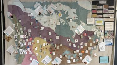
As an arts-integrated school, we continually seek opportunities to deepen our understanding of the curriculum through meaningful, schoolwide projects. This year, our staff was inspired to honour and elevate Indigenous ways of knowing by creating a large-scale map that reflects the rich cultural and ecological diversity of this land. What began as a visual representation of Canada’s physiographic regions has grown into a collaborative exploration of Indigenous culture—featuring local plants and animals, traditional languages, Nation flags, and research into the history and impact of residential schools. This project aligns with our district’s Indigenous Enhancement Agreement by fostering cultural identity, supporting place-based learning, and encouraging students to engage with the land and its stories in a respectful and meaningful way.
Student Contributions to the Map Project
Throughout the year, students across multiple grades contributed to the creation of our schoolwide map, each bringing a unique project through their subject areas:
- In English First Peoples 10, students painted the map’s physical geography, including the Canadian Shield, Plains, Great Lakes–St. Lawrence Lowlands, Appalachian Region, Western Cordillera, Hudson Bay Lowlands, and Arctic Archipelago—laying the foundation for all other contributions.
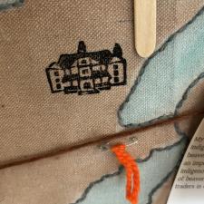
- Grade 10 Social Studies students explored the historical and ongoing injustices that challenge Canada’s identity as an inclusive, multicultural nation. They researched residential schools across the country and designed commemorative stamps, which were added to the map to honour the children and communities affected
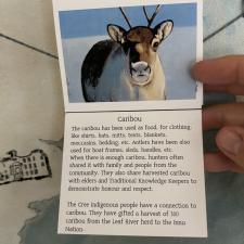
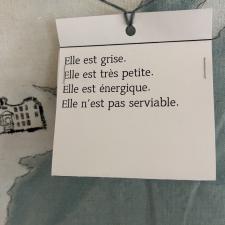
- In Grade 7 French, students studied animals native to Canada’s diverse regions. They created flipbooks featuring each animal alongside descriptive phrases in French, which were then placed on the map to reflect the linguistic and ecological diversity of the land.
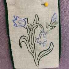
- Grade 8 Science students investigated Indigenous knowledge of plants and created negative relief stamps of helpful native species, highlighting the deep connection between Indigenous communities and the natural world.
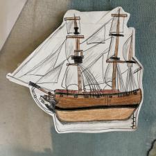
- During lessons on colonialism, Grade 8 Social Studies students illustrated the ships used by early European explorers, such as Captain James Cook, to represent the arrival of settlers and the beginning of colonial impact.
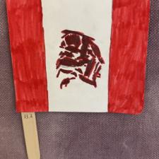
- Grade 6 students studied the languages, flags, and emblems of various Indigenous Nations, contributing visual elements that celebrate cultural identity and sovereignty.
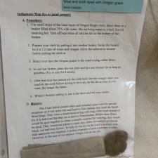
- Specialized Science 12 students researched natural dyes traditionally used by Indigenous peoples. They conducted experiments using materials like onion skins, Oregon grape root and porcupine quills to create dyed pieces, connecting science with traditional ecological knowledge.
Looking Ahead
This collaborative project not only deepened curricular learning but also supported the goals of the Indigenous Enhancement Agreement by fostering cultural identity, encouraging place-based learning, and promoting respectful engagement with Indigenous histories and perspectives.
Our school is proud to be located on the traditional and unceded territory of the Semá:th First Nation, overlooking the land where Semá:th Lake once stood. This map will be shared with the broader community during the National Day for Truth and Reconciliation in September, where it will be on public display at the School Board Office.
